 Export view
Exports current visible view to a file. This may be either PDF file or raster image. Image is scaled so that it fits the chosen output format.
Generated file includes scale bar if visible. Active and selected objects are cleared before image generation and active mode is cancelled.
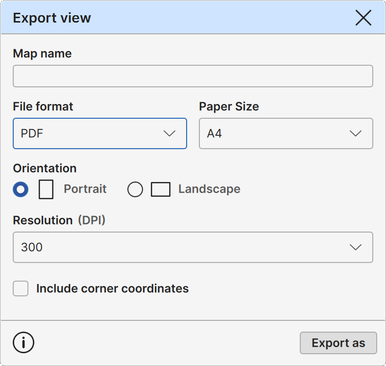
Map name
Name for the written file. If empty, active file name is used.
File format
First option creates PDF file with given paper settings. Other options create raster file with given image format. Raster file aspect ratio is determined by he visible canvas area. Pixel resolution comes from the DPI setting below.
Raster image format selection depends on files in view:
PNG: Lossless compressed format suitable for line maps.
TIF: Lossless compressed format suitable for line maps. Additionally supports coordinates within file itself.
JPG: Lossy compressed format suitable only for aerial images.
Paper size
List of PDF paper sizes. In addition to the standard sizes (A5 - A0), there is option for defining custom paper size in millimeters. When selected, width and height settings become visible below.
Orientation
Orientation of standard PDF paper sizes: portrait or landscape.
Width, Height
Width and height of PDF file in millimeters. These become available when custom size is selected from the paper size list above.
Resolution (DPI)
Output image pixel resolution in DPI (dots per inch). Affects both raster and PDF files.
Include corner coordinates
Writes image coordinates to the separate file and, if the format supports it, inside the raster file itself.
Following Esri World file conventions are used:
PNG: Coordinates are written to a file with the extension .pgw.
TIF: Coordinates are written to a file with the extension .tfw. Additionally, coordinates are written to the file itself using GeoTIFF extensions.
JPG: Coordinates are written to a file with the extension .jgw.